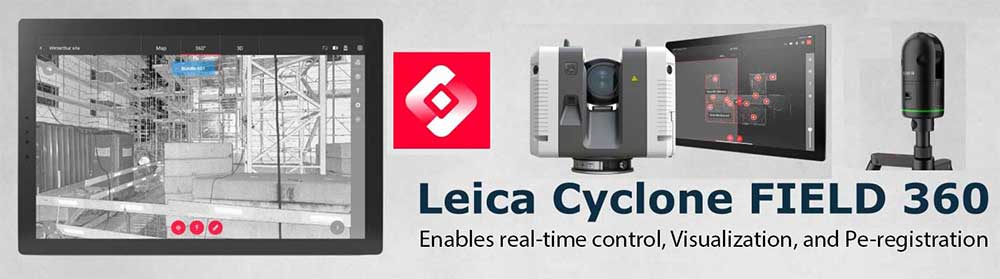
Leica Cyclone FIELD 360 is the mobile bridge between Leica scanners and office workflows — enabling real-time control, preview, and pre-registration of point clouds in the field. This guide explains features, compatibility, step-by-step workflows, best practices, and device/licensing requirements so you can master on-site scan capture.
Introduction: The Role of Leica Cyclone FIELD 360 in Modern Laser Scanning
Why Field Software Is Essential for Real-Time Data Validation
In traditional scanning workflows operators often discover registration problems after returning to the office — leading to delays and costly re-visits. Cyclone FIELD 360 removes that pain point by providing instant previews, automated pre-registration, and QA tools so you can confirm coverage and alignment on-site.
Leica’s Integration Between Hardware and Software
Leica built FIELD 360 to tightly integrate with its hardware ecosystem (notably the RTC360 and BLK360). The result is a closed-loop workflow: capture in the field, pre-register and annotate on the tablet, then import into Cyclone REGISTER 360 for final processing and export to CAD/BIM.
What Is Leica Cyclone FIELD 360?
Core Purpose and Functionality
Cyclone FIELD 360 is a mobile app for tablets that enables:
- Remote scanner control (start/stop scans, adjust settings)
- Real-time point cloud previews and visualization
- Automated pre-registration using VIS (when available)
- On-site annotations, photographs, and geotags
- Data packaging and sync to office processing tools
Compatible Scanners: BLK360, RTC360, and Others
FIELD 360 commonly supports:
- Leica RTC360 — full feature set including VIS-enabled pre-registration.
- Leica BLK360 (G1 & Gen 2) — capture, preview, and tagging support.
- BLK2GO / P-series — some synchronization features depending on firmware and Leica updates.
Mobile App Platforms and System Requirements
Recommended devices:
- iPadOS: iPadOS 15 or later — iPad Pro / Air models preferred.
- Android: Android 11 or later, tablets with ≥4GB RAM (Wi-Fi 6 recommended).
Key Features of Cyclone FIELD 360
Real-Time Scan Visualization and Pre-Registration
One of FIELD 360’s standout features is the ability to render an interactive preview of each scan station immediately after capture. When used with VIS-enabled scanners (like RTC360), FIELD 360 performs automatic pre-registration so you can inspect alignment quality on-site.
Annotating, Tagging, and Photographing Scan Data
FIELD 360 lets you attach:
- Photos for context and evidence
- Text notes and tags (e.g., “M&E room”, “blocked access”)
- Geolocation metadata for easier project organization
VIS (Visual Inertial System) Integration with RTC360
VIS combines imagery and inertial sensors on the scanner to track motion and automatically align scans without targets. FIELD 360 reads VIS information and performs real-time pre-registration — dramatically reducing office processing time.
Connectivity and Data Management in the Field
FIELD 360 supports direct Wi-Fi connections to scanners and can transfer captured packages via USB-C, local Wi-Fi networks, or Leica cloud services. Projects can be staged locally and synced when convenient.
How Cyclone FIELD 360 Works: Step-by-Step Workflow
Step 1: Connecting to Your Scanner
Power up the scanner, enable its Wi-Fi hotspot (or connect over local network), launch FIELD 360 and pair. The app lists available scanners and projects — select or create a project and configure scan parameters (resolution, HDR images, etc.).
Step 2: Capturing and Reviewing Scans in Real Time
Start each scan from the tablet. After capture FIELD 360 displays a quick point-cloud preview. Rotate, zoom, and inspect the dataset to confirm coverage and exposure.
Step 3: Pre-Registration and Quality Control
If using VIS-capable hardware, FIELD 360 attempts to align successive scans automatically. The app flags potential misalignments — allowing you to re-scan or add tie-ins before leaving the site.
Step 4: Exporting and Syncing Data with REGISTER 360
When capture is complete, package the project and transfer it to the office (USB, Wi-Fi, or cloud). Import into Cyclone REGISTER 360 (or REGISTER 360 PLUS) for final registration, cleaning, georeferencing, and export to CAD/BIM formats.
Advantages of Using Cyclone FIELD 360 in the Field
Time Efficiency and Real-Time Validation
On-site previews and automatic pre-registration let you detect missing coverage immediately — eliminating return visits and reducing project turnaround times.
Reducing Office Workload and Manual Errors
FIELD 360 automates many manual tasks, lowering the chance of human error in scan ordering and initial alignment — saving hours in post-processing.
One-App Solution for Both Field and Office Workflows
FIELD 360 tightly pairs with REGISTER 360 and the broader Cyclone ecosystem, enabling a streamlined, auditable workflow from capture to deliverable.
Leica Cyclone FIELD 360 vs Other Field Scanning Apps
FIELD 360 stands out because of its deep hardware integration and VIS-enabled pre-registration. Competing mobile apps (Autodesk ReCap Mobile, FARO Scene Mobile) offer useful features but typically lack the same level of automated registration and direct compatibility across Leica’s product line.
Integration with Other Leica Software Tools
Syncing with Cyclone REGISTER 360 and REGISTER 360 PLUS
Projects exported from FIELD 360 import into REGISTER 360 with preserved metadata, relationships, and pre-registration results — allowing rapid finalization and export.
Streaming Data via Leica CloudWorx to CAD/BIM Tools
After final registration, use CloudWorx plug-ins to stream or extract data directly into AutoCAD, Revit, MicroStation, or Navisworks for modeling, clash detection, and documentation.
Practical Applications of Cyclone FIELD 360
- Construction: as-built validation and QA on multi-floor projects.
- Heritage: capturing fragile sites quickly with minimal intrusion.
- Industrial: plant surveys with immediate verification of complex piping and access ways.
- Architecture: ensure thorough coverage before demobilizing from site.
Device and Licensing Requirements
Supported Devices (iOS, Android, Tablets)
FIELD 360 runs on modern tablets. Recommended:
- iPad Pro / iPad Air (2020+) with iPadOS 15+
- Android tablets (Android 11+, 4GB+ RAM), Galaxy Tab S series recommended
Licensing Options: Subscription and Perpetual Models
FIELD 360 itself is generally freely available to install, but full export, advanced integrations and enterprise features require Cyclone REGISTER 360 or other Cyclone licenses. Leica offers subscription and perpetual licensing — check with Leica or authorized resellers for current options.
Tips for Getting the Most Out of Cyclone FIELD 360
Optimizing Scan Paths and Registration Accuracy
Plan logical, overlapping scan sequences. Keep follow-up setups within VIS tracking range to reduce drift. Use visual anchors (photos) and overlap to improve pre-registration reliability.
Managing Large Projects Efficiently
Segment projects into zones or floors. Use meaningful naming conventions and tags so that post-processing teams can quickly identify areas and priorities.
Battery and Data Transfer Best Practices
Carry spare batteries for long jobs, use fast USB-C transfer or SSD offloads for large datasets, and clear temporary cache on tablets regularly to avoid performance slowdowns.
Frequently Asked Questions
Conclusion: Empowering Real-Time Scanning with Leica Cyclone FIELD 360
Leica Cyclone FIELD 360 is a transformative tool for modern scanning teams. By enabling immediate visualization, automated pre-registration with VIS, and rich metadata capture in the field, it reduces rework, accelerates project timelines, and creates a smoother handover to office processing tools like Cyclone REGISTER 360 and CloudWorx. For teams using RTC360 or BLK360 hardware, mastering FIELD 360 is essential to getting the most out of your reality-capture workflows.
Learn more at: Leica Geosystems.