The Leica RTC360 is one of the most advanced 3D laser scanners designed for professionals who demand speed, accuracy, and reliable field-to-office workflows. This article explains what the RTC360 does and the essential software you need — including Cyclone FIELD 360, Cyclone REGISTER 360 PLUS, and CloudWorx — so it works fully in the field and integrates smoothly with CAD/BIM systems.
What Is the Leica RTC360 and Why It’s a Game-Changer
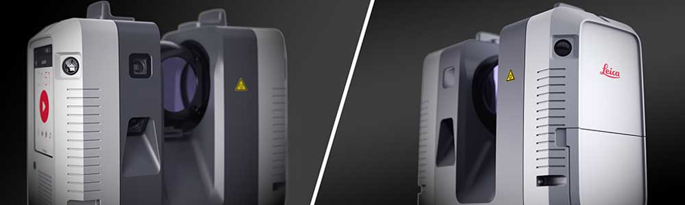
Overview of the Leica RTC360 3D Laser Scanner
The Leica RTC360 is a lightweight, high-speed terrestrial laser scanner by Leica Geosystems. Built for fast reality capture, it can collect high-density point clouds and HDR imagery quickly while enabling targetless registration — saving time during both capture and post-processing.
Key Features That Make the Leica RTC360 Stand Out
- High speed: Up to 2,000,000 points per second.
- VIS technology: Built-in Visual Inertial System for automatic, targetless registration.
- HDR imaging: Integrated camera system for colorized point clouds and visual documentation.
- Portable: Lightweight design suitable for single-operator workflows.
- Ruggedness: IP54 rating for basic field durability.
Core Software Ecosystem Required for Leica RTC360
Leica Cyclone FIELD 360: The Mobile Companion App
Cyclone FIELD 360 is the mobile control and visualization application that pairs with the RTC360. Running on a tablet (iOS or Android), it connects to the scanner over Wi-Fi and allows remote control of captures, live preview of scans and photos, adding site notes, and performing pre-registration using VIS data so quality checks can be performed before leaving the site.
Features and Functions of Cyclone FIELD 360
- Remote scan control and job management.
- On-site visualization of pre-registered point clouds.
- Add annotations, tags, and photos tied to scans.
- Offline capture and local storage with later sync.
Leica Cyclone REGISTER 360 PLUS: Office Processing Software
Back in the office, Cyclone REGISTER 360 PLUS finalizes and cleans the point cloud data. It accepts the pre-registered field data, provides tools for manual and automated registration, error checking, georeferencing, and exports to formats compatible with CAD, BIM, or GIS platforms.
Point Cloud Registration and Project Management
REGISTER 360 PLUS facilitates automated alignment, manual fine-tuning, and project-level organization for medium-to-large point cloud datasets. It also generates deliverables and reports for QA/QC.
Integration with BIM, CAD, and GIS Software
Export options include standard point cloud formats and direct streaming through Leica CloudWorx plug-ins so design teams can work with the point cloud inside their preferred authoring tools.
Leica CloudWorx Plug-Ins for CAD and Revit
CloudWorx plug-ins provide tight integration between Cyclone databases and CAD/BIM platforms (Revit, AutoCAD, MicroStation, Navisworks), enabling designers to extract sections, create models, and perform clash detection without importing massive files.
Hardware Specifications and Technical Details of Leica RTC360
| Leica RTC360 — Key Specifications | |
|---|---|
| Measurement rate | 2,000,000 points/second |
| Range | Up to ~130 m (depending on conditions) |
| Typical accuracy | ~1.9 mm at 10 m (manufacturer specs) |
| VIS System | Visual Inertial System for targetless registration |
| Weight | ~5.35 kg (with battery) |
| Scan time | Full-dome scans in under 2 minutes (config dependent) |
| IP Rating | IP54 (dust and splash resistant) |
Workflow: From Field to Finished Model
- Field capture: Use the RTC360 controlled by Cyclone FIELD 360 to perform multiple setups and capture point clouds and HDR images.
- Pre-registration: VIS performs automatic, targetless pre-registration on the tablet so you can QA on site.
- Office processing: Import into Cyclone REGISTER 360 (or REGISTER 360 PLUS) to finalize registration and georeference your data.
- Design integration: Stream or export to CAD/BIM via CloudWorx or standard formats for modeling, clash detection, or as-built documentation.
Practical Applications
- Construction: As-built verification, progress monitoring and clash detection.
- Heritage preservation: Detailed 3D documentation of monuments and artifacts.
- Industrial plants: Precise modelling of piping and equipment for retrofits.
- Forensics: Scene reconstruction and evidence documentation.
Advantages of Using Leica RTC360
- Fast captures — drastically reduce time on site.
- Portable and operable by a single user for many tasks.
- High-quality point clouds with accurate color and HDR images.
- Field-to-office synchronization cuts post-processing time.
Comparisons & Notes
When comparing the RTC360 to other scanners (for example Leica BLK360 or FARO Focus units), consider trade-offs in range, portability, speed, and integration. The RTC360 excels at fast, medium-range scans with strong field registration, but other scanners may be favorable for ultra-long range or budget-constrained projects.
Maintenance, Calibration, and Support
Regular firmware and software updates are recommended. Leica Geosystems provides support, training resources, and maintenance plans that help sustain long-term accuracy and reliability.
Cost, Licensing, and Availability
Pricing for the hardware and software licensing varies by region and configuration. Expect to budget for the scanner, Cyclone software licenses, and any CloudWorx plug-ins required for your CAD/BIM environment. Contact Leica Geosystems or an authorized reseller for current quotes and software bundles.
Frequently Asked Questions
Conclusion: Why Leica RTC360 Is the Future of High-Speed Reality Capture
The Leica RTC360 is more than a laser scanner — it’s a field-to-office ecosystem. Combined with Cyclone FIELD 360, Cyclone REGISTER 360 PLUS, and CloudWorx plug-ins, it enables fast captures, reliable registration, and streamlined workflows into CAD/BIM environments. For surveyors, engineers, and BIM professionals seeking to save time and improve accuracy, the RTC360 remains one of the top investments for modern reality capture.
To use it ”fully” in the field and afterwards in the office (registration, processing, deliverables), you’ll want several software components. I’ll outline what you need and what’s recommended, so you have a clearer workflow.
What you need for field usage
On-site with the RTC360 you’ll typically use:
- The scanner hardware itself (RTC360) and its internal firmware (make sure it’s up to date).
- A field app for capturing & doing a preliminary registration: specifically, Cyclone FIELD 360 from Leica Geosystems. The official product page says: “Combined with Cyclone FIELD 360 software for automated registration in the field”.
- The ability to transfer the captured scan data (point clouds, images, metadata) from the scanner/field device to your office computer for further processing.
So in the field you must have at least: the scanner, the firmware, the field app (Cyclone FIELD 360).
What you need for office processing / deliverables
Once you’re back in the office, you’ll want software to register scans (merge scan stations), clean / process the point cloud, export to CAD/BIM formats, integrate with other survey data. Typical software includes:
- Cyclone REGISTER 360 PLUS — this is Leica’s registration/post-processing software for their laser scanner data. The laser‐scanner software page lists this as part of the workflow.
- Leica Infinity — Leica’s surveying/office software. According to a Leica article, Infinity supports direct import of RTC360 scan setups and integrates survey data + scans.
- Optional/Recommended: Plugins or CAD integration tools (for example, Leica’s CloudWorx plugins) so you can bring point clouds into CAD/BIM tools.
- Make sure your workstation meets the specs (for REGISTER 360 & large point-clouds) — e.g., Windows 10/11 64-bit, sufficient RAM, graphics support.
Suggested workflow in simple terms
- On site: Use RTC360 + Cyclone FIELD 360 to capture scans, do a preliminary registration/check on site (so you know you got everything).
- Transfer your scan data to the office.
- In office: Use Cyclone REGISTER 360 PLUS to do full registration, alignment, combine scan stations, clean point cloud.
- Export point cloud (E57, PTX, etc) or use Infinity/CAD plugins to bring into CAD/BIM or catalogue/measure & deliver.
- Use CAD/BIM tools or point-cloud viewers/traversal tools for final deliverables.
Learn more from the official manufacturer: Leica Geosystems