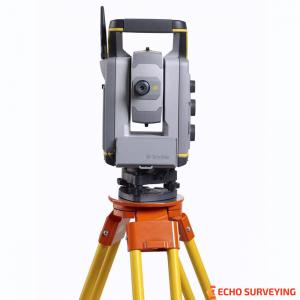

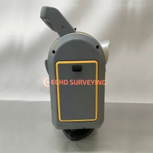

Used Trimble SX10 Scanning Total Station for sale, 1” Angular Accuracy, still like new, low hours used and everything is sin excellent perfect working order
Used Trimble SX10 Scanning Total Station for sale, 1” Angular Accuracy, still like new, low hours used, fully shop tested, serviced and certified by Trimble authorized, and comes with 1-year Trimble extension warranty for both parts and labour. Everything is sin excellent perfect working order and works flawlessly with Trimble working standards
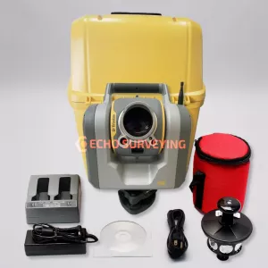
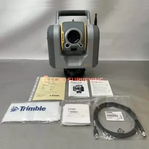
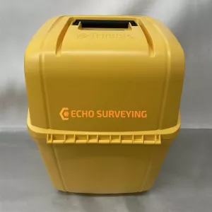
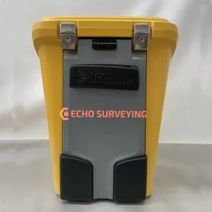
This Trimble SX10 Scanning Total Station sale includes:
Trimble SX10 SCANNING TOTAL STATION
The Trimble SX10 scanning total station redefines the capabilities of everyday survey equipment by providing the world’s most innovative solution for surveying, engineering, and scanning professionals. The Trimble SX10 will change the way you work. This new, versatile solution is capable of collecting any combination of high-density 3D scan data, enhanced Trimble VISION imaging, and high accuracy total station data, allowing you to capture exactly what you need, saving you time and money on every job
FASTER, EASIER AND MORE PRODUCTIVITY
Our seven total stations, C3, C5, S5, S7, S9, S9 HP and the SX10; deliver even greater performance and more features than ever. Together, they offer a clear choice—between an all in one station for maximum flexibility, an everyday workhorse designed for basic surveying, and an extremely precise model for specialized needs. They’re all backed by Trimble’s legendary training, service and support.
At Trimble, we’re constantly focused on making the dayto-day job of surveying faster, easier and more productive. All of our total stations’ features, functions and software components are designed to boost efficiency in the field and in the office without compromising performance and accuracy.
Our EDM technology enables faster in-field measurements with fewer setups while enhancing scanner performance. SurePoint technology reduces aiming errors and costly re-measurements. Our proven field software, Trimble Access, ensures quick data capture in the field. Trimble SureScan technology boosts accuracy, ensures repeatability, and cuts the time necessary to return to the field to collect additional data. It doesn’t stop there.
Data processing is easier and faster using Trimble Business Center software to integrate all of your geospatial collected data. The conclusion is clear: Trimble Total Stations offer the ultimate in efficient, reliable performance
Trimble Total Stations: trusted today, designed for tomorrow: For more than a decade, on countless jobs all over the world, Trimble Surveyor Total Stations have delivered superior performance, reliability and efficiency. But at Trimble, we are always pushing the envelope, innovating—improving
Rely on Trimble Total Stations to:
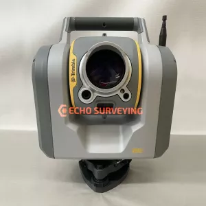
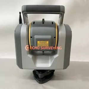
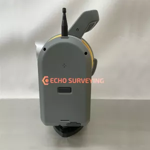
SX10 Scanning Total Station
MERGE ALL OF THE GEOSPATIAL SKILLSETS IN YOUR WORKFLOW
The TrimbleSX10 is the world’s first scanning total station that truly merges high-speed 3D scanning, enhanced Trimble VISION imaging and high accuracy total station measurements in a single instrument. Designed from the ground up to provide maximum accuracy, efficiency and detail, this scanning total station features Trimble’s trusted MagDrive and Autolock technologies for industry-leading durability and reliability. And the SX10’s powerful new Lightning 3DM has the capabilities you need to handle any survey project
Boost productivity, save money and get greater versatility
The Trimble SX10 captures rich point cloud data at 26,600 points per second and at a range of up to 600 m. When you get back to the office, the scans register automatically, so you spend less time preparing data and more time creating results. And, since Trimble Access and Trimble Business Center allow operation of the SX10 within familiar survey workflows, there’s no need for specialized training, dedicated 3D scanners and personnel. The Trimble SX10 delivers reduced costs and greater versatility to expand to new applications, all with a single investment
A foundation of superior 3D scanning
At the heart of the Trimble SX10 are fully integrated 3D scanning capabilities. Trimble’s Lightning technology allows the Trimble SX10 to measure dense 3D scan data at high speeds while maintaining high precision over the full measurement range. You can choose your level of scan density, based on your project. Since registration is automatic, the data you gather drops right into your survey coordinate system.
Key features of SX10 Total Station:
The Trimble SX10 Scanning Total Station enables familiar, easy and efficient survey workflows, from the field to the office. Here’s how:
ADVANCED VISION TECHNOLOGY THAT HELPS YOU DELIVER SUPERIOR RESULTS
The VISION technology onboard the Trimble SX10 makes it easy to direct surveys via live video on the controller. VISION offers varying levels of imaging capabilities and resolutions, so you can collect just the right amount of data to fit your needs, whether you’re documenting your site or capturing additional visual detail on your DR observations. Back in the office, Trimble VISION data gives you the option of making additional measurements or delivering 360-degree panoramas.
Unparalleled Precision That’s the Trimble SX10
The Trimble SX10 Scanning Total Station sets a new standard for accuracy, capability and performance. Whether you’re performing a typical job or your most challenging survey projects, the SX10 delivers the confidence to do it all and do it well.
FAMILIAR TRIMBLE ACCESS AND TRIMBLE BUSINESS CENTER WORKFLOWS
Combined with Trimble Access software, the SX10 efficiently and reliably collects the most complete dataset from the field. While in the field, it allows you to:
In the office, Trimble Business Center seamlessly integrates your project data and provides a virtual surveying environment enabling:
SX10 Applications
| SURVEY PERFORMANCE | ||
| ANGLE MEASUREMENT | ||
| Sensor type | Absolute encoder with diametrical reading | |
| Angle measurement accuracy | 1” (0.3 mgon) | |
| Angle display (least count) | 0.1” (0.01 mgon) | |
| AUTOMATIC LEVEL COMPENSATOR | ||
| Type | Centered dual-axis | |
| Accuracy | 0.5” (0.15 mgon) | |
| Range | ±5.4’ (±100 mgon) | |
| Electronic 2-axis level, with a resolution of | 0.3” (0.1 mgon) | |
| Circular level in tribrach | 8’/2 mm | |
| DISTANCE MEASUREMENT | ||
| Accuracy | ||
|
Standard Tracking |
1 mm + 1.5 ppm 2 mm + 1.5 ppm |
|
Standard | 2 mm + 1.5 ppm |
| Measuring time | ||
| Prism mode | Standard | 1.6 s |
| DR mode | Standard | 1.2 s |
| Range | ||
| Prism mode | 1 prism | 1 m – 5,500 m |
| DR mode | Kodak White Card (Catalog number E1527795) | 1 m – 800 m |
| Kodak Grey Card (Catalog number E1527795) | 1 m – 450 m | |
| Autolock and Robotic Range | ||
| Autolock range - traverse 50 mm | 1 m – 800 m | |
| Autolock range - 360 prism | 1 m – 300 m6 / 700 m | |
| Angle accuracy | 1” | |
| SCANNING PERFORMANCE | ||
| GENERAL SCANNING SPECIFICATIONS | ||
| Scanning principle | Band scanning using rotating prism in telescope | |
| Measurement rate | 26.6 kHz | |
| Point spacing | 6.25 mm, 12.5 mm, 25 mm or 50 mm @ 50 m | |
| Field-of-view | 360° x 300° | |
| Coarse scan; full dome - 360° x 300° (horizontal angle x vertical angle) Density: 1 mrad, 50 mm spacing @ 50 m |
Scan time: 12 minutes | |
| Standard scan; area scan - 90° x 45° (horizontal angle x vertical angle) Density: 0.5 mrad, 25 mm spacing @ 50 m |
Scan time: 6 minutes | |
| RANGE MEASUREMENT | ||
| Range principle | Ultra-high speed time-of-flight powered by Trimble Lightning technology | |
| Range | ||
| Kodak White Card (Catalog number E1527795) Kodak Gray Card (Catalog number E1527795) |
0.9 m – 600 m 0.9 m – 350 m |
|
| Range noise | ||
| @ 50 m on 18–90% reflectivity | 1.5 mm | |
| @ 120 m on 18–90% reflectivity | 1.5 mm | |
| @ 200m on 18-90% reflectivity | 1.5mm | |
| @ 300m on 18-90% reflectivity | 2.5mm | |
| Scanning Accuracy | ||
| Scanning Angular Accuracy | 5” (1.5mgon) | |
| 3D position Accuracy @ 100m | 2.5mm | |
| EDM SPECIFICATIONS | ||
| Light source | Pulsed laser 1550 nm; Laser class 1M | |
| Beam divergence DR mode | 0.2 mrad | |
| Laser spot size at 100 m (FWHM) | 14 mm | |
| Atmospheric correction | Available through field and office software | |
| IMAGING PERFORMANCE | ||
| Imaging principle | 3 calibrated cameras in telescope powered by Trimble VISION technology | |
| Cameras total field of view | 360° x 300° | |
| Live view frame rate (depending on connection) | Up to 15 fps | |
| File size of one total panorama with overview camera | 15 MB – 35 MB | |
| CAMERAS SPECIFICATIONS | ||
| General Camera Specifications | ||
| Resolution of each camera chip | 5 MP (2592 x 1944 pix) | |
| File format of images | .jpeg | |
| Field of view max | 57.5° (horizontal) x 43.0° (vertical) | |
| Field of view min | 0.65° (horizontal) x 0.5° (vertical) | |
| Total zoom (no interpolation) | 84 x | |
| 35 mm equivalent focal length | 36–3000 mm | |
| Exposure modes | Auto, spot exposure | |
| Manual exposure brightness | ±5 steps | |
| White balance modes | Auto, daylight, incandescent, overcast | |
| Temperature compensated optics | Yes | |
| Calibrated cameras | Yes | |
| Overview Camera | ||
| Position | Parallel to measurement axis | |
| One pixel corresponds to | 20 mm @ 50 m | |
| Primary Camera | ||
| Position | Parallel to measurement axis | |
| One pixel corresponds to | 4.4 mm @ 50 m | |
| Telescope Camera | ||
| Position | Coaxial | |
| Focusing | Automatic, manual | |
| Focusing distance | 1.7 m to infinity | |
| One pixel corresponds to | 0.88 mm @ 50 m | |
| Pointing precision (std dev 1 sigma) | 1” (HA: 1,5 cc, VA: 2,7 cc) | |
| Plummet Camera | ||
| Usable range | 1.0–2.5 m | |
| Resolution on ground - one pixel corresponds to | 0.2 mm @ 1.55 m instrument height | |
| Accuracy | 0.5 mm @ 1.55 m instrument height | |
| GENERAL SPECIFICATIONS | ||
| Communication | WiFi, 2.4 Ghz Spread Spectrum, cabled (USB 2.0) | |
| IP-rating | IP55 | |
| Operating temperature range | –20 °C to 50 °C | |
| Security | Dual layer password protection | |
| SYSTEM SPECIFICATIONS | ||
| SERVO SYSTEM | ||
| MagDrive servo technology | Integrated servo/angle sensor electromagnetic direct drive | |
| Clamps and slow motions | Servo-driven | |
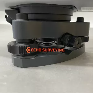
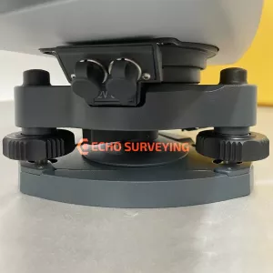
| CENTERING | ||
| Centering system | Trimble 3-pin | |
| Plummets | Built-in video plummet | |
| Split optics tribrach with optical plummet | ||
| POWER SUPPLY | ||
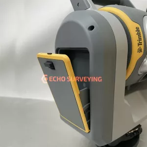
| Internal battery | Rechargeable Li-Ion battery 11.1 V, 6.5 Ah | |
| Operating time | ||
| One internal battery | Approx. 2–3 hours | |
| Three internal batteries in multi-battery adapter | Approx. 6–9 hours | |
| WEIGHT AND DIMENSIONS | ||
| Instrument | 7.5 kg | |
| Tribrach | 0.7 kg | |
| Internal battery | 0.35 kg | |
| Trunnion axis height | 196 mm | |
| Front lens aperature | 56 mm | |