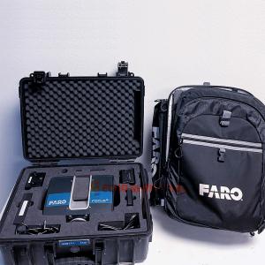

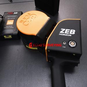
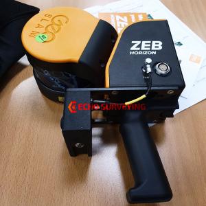
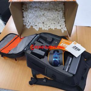
Used GeoSLam ZEB-HORIZON for sale, still like new, been used as demonstration by trained only. Everything still in excellent perfect working condition, includes GeoSLAM Hub & Draw Start license
Beside providing brand new GeoSLam ZEB-HORIZON, we also providing used GeoSLam ZEB-HORIZON as great alternatives to expand business without a huge capital investment
For sale used GeoSLam ZEB-HORIZON, like new and everything still in excellent perfect physical condition. Only been used as demonstration by trained engineer, has been shop test routine by authorize GeoSLam service to be ready to working to scan condition
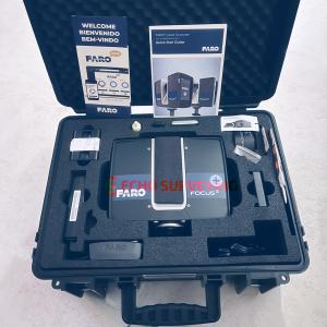
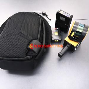
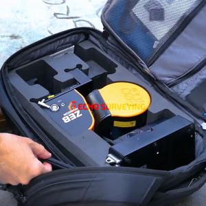
Package includes:
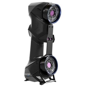
The ZEB HORIZON offers outstanding visibility and can capture intricate measurements from up to 100m, its lightweight and compact design also makes it great for indoor and outdoor surveys. Create a map as you move. Outdoors, indoors or underground. It’s lightweight and compact design makes it simple whether you’re new to digital mapping, or a trained surveyor. With powerful SLAM technology at its heart (we call it GeoSLAM Beam), the ZEB Horizon can be used in areas with poor GPS – such as underground or in forests. Lightweight and rugged, simple to use, fast to capture and easy to process giving you the most accurate information you need to make the most important decisions.
The ZEB Horizon is as flexible as you are. Use handheld or pair with one of our many mounting options. Take your ZEB to the skies by mounting to a UAV or reach those difficult places with the cradle or pole
Powerful performance
Harnessing GeoSLAM’s powerful SLAM (Simultaneous, Localisation And Mapping) technology, the ZEB-HORIZON can be used in outdoor areas with limited GPS signal, such as underground or in dense forest environments.
With a collection rate of 300,000 points per second and an accuracy of 1-3cm (depending on what scan environment), the ZEB-HORIZON is also ideal for those working in construction, architecture, engineering and surveying.
The versatility of the ZEB-HORIZON allows data to be collected for all projects including 2D floor plan generation, 3D volumetric calculations, measured building calculations, scan-to-BIM and object identification. The simple ‘walk-and-scan’ method of data collection, allows even the most inexperienced operator to create accurate results at speed.
Complete versatility
The versatility of the scanner allows the system to be used in combination with different equipment to suit any type of survey, including:
Technical Specification
General
Application
Scanning Characteristics
Operation Characteristics
Power
More information
Functionality
Connectivity and Sensors
Other Sensors and Ports: Etherne