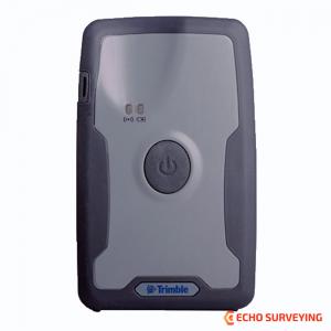
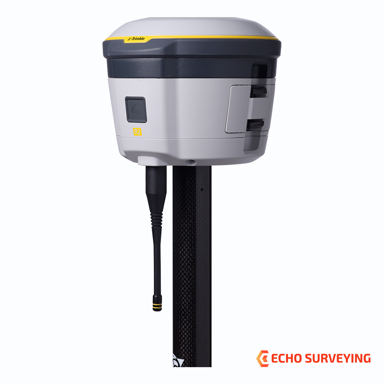
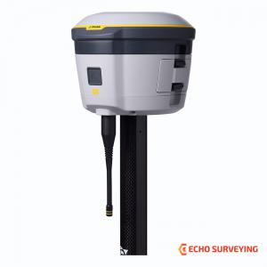
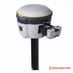
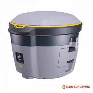
Trimble R2 for sale, RTK Rover with GPS GNSS Receiver, UHF 450 MHz receive radio
Trimble R2 for sale, RTK Rover with GPS GNSS Receiver, UHF 450 MHz receive radio
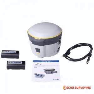
Trimble R2 sale including
The Trimble R2 is a compact, durable GNSS receiver that provides an easy-to-use solution for GIS and survey professionals who need to collect highly accurate data in a wide range of geospatial applications. Capable of delivering between submeter and centimeter positioning accuracy in real-time to any mobile device via a wireless Bluetooth® connection, the R2 receiver gives you total flexibility to choose a solution based on the accuracy and GNSS performance level that suits your application, letting you work the way you want
High accuracy for survey & GIS applications
Flexible solution
Simple, rugged system
TRIMBLE R2 GNSS RECEIVER DATA SHEET
| CONFIGURATION OPTION | |
| Type | Smart antenna |
| Base operation | Yes. Logging only |
| Rover operation | Yes |
| Rover position update rate | 1 Hz, 2 Hz, 5 Hz |
| Rover operation within a VRS Now network | Yes |
| MEASUREMENTS | |
|
|
| POSITIONING PERFORMANCE | |
| SBAS (WAAS/EGNOS/MSAS/GAGAN) Positioning | |
| Horizontal accuracy | ±0.50 m (1.6 ft) |
| Vertical accuracy | ±0.85 m (2.8 ft) |
| Code Differential GPS Positioning | |
| Correction type | DGPS RTCM 2.x |
| Correction source | .IBSS |
| Horizontal accuracy | ±(0.25 m + 1 ppm) RMS ±(0.8 ft + 1 ppm) |
| Vertical accuracy | ±(0.50 m + 1 ppm) RMS ±(1.6 ft + 1 ppm) |
| Static GNSS Positioning | |
|
Static and Fast Static
|
|
| Trimble RTX Positioning | |
CenterPoint RTX
|
|
| FieldPoint RTX™ | 10 cm Horizontal RMS |
| RangePoint® RTX | 30 cm Horizontal RMS |
| ViewPoint RTX | 50 cm Horizontal RMS |
| RTK Positioning2 | |
| Horizontal accuracy | 10 mm + 1 ppm RMS (0.033 ft + 1 ppm RMS) |
| Vertical accuracy | .20 mm + 1 ppm RMS (0.065 ft + 1 ppm RMS) |
| Network RTK2 | |
| Horizontal accuracy | 10 mm + 0.5 ppm RMS (0.033 ft + 0.5 ppm RMS) |
| Vertical accuracy | 20 mm + 0.5 ppm RMS (0.065 ft + 0.5 ppm RMS) |
| BATTERY AND POWER | |
| Internal | Replaceable internal battery 7.4 V, 2800 mA-hr, Lithium-ion |
| External | Power input on the Mini-B USB connector, non-charging as per the USB standard 10 W USB adapte |
| Power consumption | 4.95 W (VFD 100%), 3.7 W (VFD 12.5%) at 18 V, in rover mode |
|
Operation time on internal battery |
5 hours; varies with temperature |
| MECHANICAL | |
| User interface | LED indicators for receiver status On/Off key for one-button startup |
| Dimensions | 14.0 cm (5.5 in) diameter x 11.4 cm (4.5 in) height |
| Weight | 1.08 kg (2.38 lb) receiver only |
| ENVIRONMENTAL | |
|
Temperature
|
|
| Humidity | 100% condensing |
| Waterproof | IP65 |
| Pole drop | Designed to survive a 2 m (6.6 ft) drop onto all faces and corners onto concrete (25C) |
|
Shock
|
|
| Vibration | MIL-STD-810G (Operating), Method 514.6, Procedure I, Category 4, Figure 514.6C-1 (Common Carrier, US Highway Truck Vibration Exposure) Total Grms levels applied are 1.95 g |
| INTERNAL ANTENNA | |
| Frequency Range | L1/L2 (GPS, GLONASS, Galileo, BeiDou, QZSS), MSS (RTX), L1 SBAS |
| COMMUNICATIONS | |
| USB | 1 USB 2.0 (Type B) devicE |
| Wi-Fi | Simultaneous client and access point (AP) modes |
| Bluetooth wireless technology | Fully-integrated, fully-sealed 2.4 GHz Bluetooth module5 |
| Network protocols | HTTP (web browser GUI); NTP Server, TCP/IP or UDP; NTRIP v1 and v2, Client mode; mDNS/uPnP service discovery; dynamic DNS; eMail alerts; network link to Google Earth; PPP and PPPoE |
|
Supported data formats
|
|
| External GSM/GPRS modem, cell phone support | |
|
Integrated receiving radio (optional)
|
Integrated 450 MHz UHF Radio
|
| Data Storage | 48 MHB internal memory |
| CERTIFICATIONS | |
|
IEC 60950-1 (Electrical Safety); FCC OET Bulletin 65 (RF Exposure Safety); FCC Part 15.105 (Class B), Part 15.247, Part 90; Bluetooth SIG; IC ES-003 (Class B); Radio Equipment Directive 2014/53/EU, RoHS, WEEE; Australia & New Zealand RCM; Japan Radio and Telecom MIC |
|
TRIMBLE INTEGRATED GNSS SYSTEMS COMPARATION
| Trimble R10 | Trimble R8s | Trimble R2 | Trimble R1 | |
|---|---|---|---|---|
| Max. Precision | 8 mm Horizontal / 15 mm Vertical | 8 mm Horizontal / 15 mm Vertical | 10 mm Horizontal / 20 mm Vertical | 50 cm |
| RTK Compatible | Yes | Yes | Yes | No |
| Channels | 672 | 440 | 220 | 44 |
| Antenna | Integrated | Integrated | Integrated | Integrated |
| UHF Radio | Receive & Transmit | Receive & Transmit | Receive | -- |
| xFill | Yes | No | No | No |
| Memory | 6 GB | 56 MB | 48 MB | -- |
| Cellular | Yes | Available | External | External |
| Satellites | GPS, GLONASS, Galileo, BeiDou, SBAS | Based on configuration | GPS, GLONASS, Galileo, BeiDou, SBAS | GPS, GLONASS, SBAS, BeiDou, Galileo |
Downloads