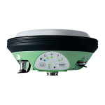


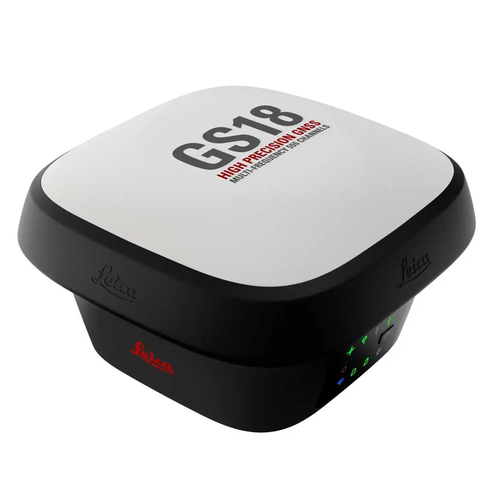
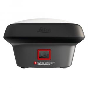
Leica GS18 I GNSS RTK Rover, versatile survey-grade GNSS RTK rover with Visual Positioning, measure points which previously could not be measured with a GNSS rover easily and accurately
Leica GS18 I GNSS RTK Rover with Visual Positioning, a versatile, survey-grade GNSS RTK rover with Visual Positioning. Designed for surveying professionals to measure points which previously could not be measured with a GNSS rover easily and accurately. Now, you can quickly capture the site in images and measure points from them, either in the field or later in the office. For GS18, I means imaging.
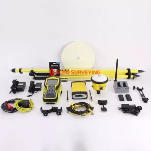
Package includes:
Leica GS18 T GNSS RTK Rover
Sensor fusion of GNSS, IMU and a camera come together to create Visual Positioning technology, resulting in a GNSS RTK rover so powerful that it enables you to measure what you see. GS18 I has all the functionality of the Leica GS18 T: in addition to Visual Positioning, users can for example map points with either tilted or levelled pole. If you looking for excellent pre-owned Leica GS18 T GNSS RTK Rover, than we currently have for sale used Leica GS18 T GNSS RTK Rover with Leica CS20 Controller, Leica Captivate, Measure & Stakeout & Stake Line. Like new condition and ready to go out of the box

Innovative
GS18 I is an accurate and easy to use GNSS RTK Rover. It utilises highly innovative Visual Positioning technology based on seamless integration of GNSS, IMU and a camera. It enables you to measure points in survey-grade accuracy from images either in the field or in the office. Alternatively, create point clouds from captured images using Leica Infinity to expand possibilities even further.
 Fast
Fast
Designed to measure a large number of points efficiently. The GS18 I allows you to capture images and measure hundreds of points within minutes with no need to physically reach the point. Time spent on-site is reduced and revisits minimised - once the site is captured, you can measure all detail whenever you want to.
 Versatile
Imaging power has changed the rules of the game. By having the power to measure what you see, you can now reach places you couldn’t before without the need to switch tools or climb through obstacles. This gives you flexibility in the field, frees up equipment and crews, truly maximises productivity, and increasing profits.
LEICA GS18 I GNSS RTK ROVER TECHNICAL SPECIFICATIONS
| GNSS TECHNOLOGY & SERVICES | ||
| Self-learning GNSS | Leica RTKplus | Adaptive on-the-fly satellite selection |
| HxGN SmartNet Global | HxGN SmartNet Pro | Network RTK and unlimited worldwide RTK bridging and PPP service |
| HxGN SmartNet+ | Network RTK and RTK bridging service | |
| HxGN SmartNet PPP | Unlimited worldwide RTK bridging and PPP service | |
| Leica SmartCheck | ontinuous check of RTK solution | Reliability 99.99% |
| Signal tracking | GPS | GLONASS | L1, L2, L2C, L5 | L1, L2, L2C, L3 |
| Galileo | BeiDou | E1, E5a, E5b, AltBOC, E6 | B1I, B1C, B2I, B2a, B3I | |
| QZSS | NavIC | L1, L2C, L5, L62 | L53 | |
| SBAS | TerraStar | WAAS, EGNOS, MSAS, GAGAN | L-Band, IP | |
| RAIM | Receiver Autonomous Integrity Monitoring | Detection and elimination of faulty satellite signals for enhanced positioning solution and GNSS integrity |
| Number of channels | 555 (more signals, fast acquisition, high sensitivity) | |
| Tilt compensation | Increased measurement productivity and traceability | Calibration-free Immune to magnetic disturbances |
| IMAGING | ||
| Measuring camera | Sensor | Field of view | Video frame rate | Global shutter with 1.2 MP | Hz 80°, V 60° | 20 Hz |
| Image group capture | 2 Hz capturing rate | Max. capturing time: 60 s, size of an image group appr. 50 MB |
| Point cloud | Leica Infinity software | Derive point clouds from image groups |
| MEASUREMENT PERFORMANCE & ACCURACY | ||
| Time for RTK initialisation | Typically 4 s | |
| Real-time kinematic (Compliant to ISO17123-8 standard) |
Single baseline Network RTK |
Hz 8 mm + 1 ppm | V 15 mm + 1 ppm Hz 8 mm + 0.5 ppm | V 15 mm + 0.5 ppm |
| Real-time kinematic tilt compensated | Not for static control points | Additional Hz uncertainty max 8 mm + 0.4 mm/° tilt down to 30° tilt |
| RTK bridging | Up to 10 min bridging of RTK outages | Hz 2.5 cm | V 5 cm |
| PPP | Initial convergence to full accuracy typically 10 min, Re-convergence < 1 min |
Hz 2.5 cm | V 5 cm |
| Post processing | Static (phase) with long observations Static and rapid static (phase) |
Hz 3 mm + 0.1 ppm | V 3.5 mm + 0.4 ppm Hz 3 mm + 0.5 ppm | V 5 mm + 0.5 ppm |
| Code differential | DGNSS | Hz 25 cm | V 50 cm |
| Image point measurement | 1-click measurement in field & office | Typically 2 cm – 4 cm (2D1) captured from 2 – 10 m distance |
| COMMUNICATIONS | ||
| Communication ports | Lemo | Bluetooth® | WLAN | USB and RS232 serial | Bluetooth® v4.0 (BLE & BR/EDR), class 1.5 | 802.11 b/g/n for field controller communication only |
| Communication protocols | RTK data protocols NMEA output Network RTK |
Leica 4G, Leica, CMR, CMR+, RTCM 2.2, 2.3., 3.0, 3.1, 3.2 MSM NMEA 0183 v4.00 & v4.10 and Leica proprietary VRS, FKP, iMAX, MAC (RTCM SC 104) |
| Built-in 4G LTE modem4 | LTE frequency bands UMTS frequency bands GSM frequency bands |
20, 8, 3, 1, 7 | 13, 17, 5, 4, 2 | 19, 3, 1 8, 3, 1 | 5, 4, 2 | 6, 19, 1 900, 1800 | 850, 900, 1800, 1900 MHz |
| Built-in UHF modem5 | Receive & transmit UHF radio modem | 403 – 473 MHz, channel spacing 12.5 kHz, 20 kHz, 25 kHz, max. 1 W output power up to 28800 bps over air | 902 – 928 MHz (licence free in North America), max 1 W output power |
| GENERAL | ||
| Field controller and software | Leica Captivate software | Leica CS20 LTE or BASIC field controller, Leica CS30 & CS35 tablets |
| User interface | Buttons and LEDs Web server |
On / Off and Function button, 8 status LEDs Full status information and configuration options |
| Data recording | Storage Data type and recording rate |
Internal memory up to 4 GB, Removable SD card Leica GNSS raw data and RINEX data at up to 20 Hz |
| Power management | Internal power supply External power supply Operating time6 |
IExchangeable Li-Ion battery (2.8 Ah / 11.1 V) Nominal 12 V DC, range 10.5 – 26.4 V DC Typical time up to 8 h |
| Weight and dimensions | Weight | Dimensions | 1.25 kg / 3.55 kg standard RTK rover setup on pole | 173 mm x 173 mm x 109 mm |
| Environmental | Temperature Drop Proof against water, sand and dust Vibration Humidity Functional shock |
-30 to +50°C operating with camera, -40 to +65°C operating without camera, -40 to +85°C storage Withstands topple over from a 2 m survey pole onto hard surfaces IP66 | IP68 (IEC60529 | MIL STD 810G CHG-1 510.6 I | MIL STD 810G CHG-1 506.6 II, MIL STD 810G CHG-1 512.6 I) Withstands strong vibration (ISO9022-36-08 | MIL STD 810G 514.6 Cat.24) 95% (ISO9022-13-06 | ISO9022-12-04 | MIL STD 810G CHG-1 507.6 II) 40 g / 15 to 23 msec (MIL STD 810G 516.6 I) |
Leica Geosystems GNSS Comparison Chart
|
|
|
|
|
|
|
||||||||||||||||||||||||||||||||||||
| Signal tracking |
Dual-frequency |
Dual-frequency |
Multi-frequency |
Multi-frequency |
Multi-frequency |
Multi-frequency |
|||||||||||||||||||||||||||||||||||
|
|
|
|
|
|
|
|||||||||||||||||||||||||||||||||||
|
|
|
|
|
|
|
|||||||||||||||||||||||||||||||||||
| Tilt compensation |
|
|
|
|
|
|
|||||||||||||||||||||||||||||||||||
| Single baseline RTK |
Hz 10 mm + 1 ppm / V 20 mm + 1 ppm |
Hz 8 mm + 1 ppm / V 15 mm + 1 ppm |
Hz 8 mm + 1 ppm / V 15 mm + 1 ppm |
Hz 8 mm + 1 ppm / V 15 mm + 1 ppm |
Hz 8 mm + 1 ppm / V 15 mm + 1 ppm |
Hz 8 mm + 1 ppm / V 15 mm + 1 ppm |
|||||||||||||||||||||||||||||||||||
| Network RTK |
Hz 10 mm + 0.5 ppm / V 20 mm + 0.5 ppm |
Hz 8 mm + 0.5 ppm / V 15 mm + 0.5 ppm |
Hz 8 mm + 0.5 ppm / V 15 mm + 0.5 ppm |
Hz 8 mm + 0.5 ppm / V 15 mm + 0.5 ppm |
Hz 8 mm + 0.5 ppm / V 15 mm + 0.5 ppm |
Hz 8 mm + 0.5 ppm / V 15 mm + 0.5 ppm |
|||||||||||||||||||||||||||||||||||
| Static (phase) with long observations |
Hz 3 mm + 0.5 ppm / V 6 mm + 0.5 ppm |
Hz 3 mm + 0.1 ppm / V 3.5 mm + 0.4 ppm |
Hz 3 mm + 0.1 ppm / V 3.5 mm + 0.4 ppm |
Hz 3 mm + 0.1 ppm / V 3.5 mm + 0.4 ppm |
Hz 3 mm + 0.1 ppm / V 3.5 mm + 0.4 ppm |
Hz 3 mm + 0.1 ppm / V 3.5 mm + 0.4 ppm |
|||||||||||||||||||||||||||||||||||
| Static and rapid static (phase) |
Hz 5 mm + 0.5 ppm / V 10 mm + 0.5 ppm |
Hz 3 mm + 0.5 ppm / V 5 mm + 0.5 ppm |
Hz 3 mm + 0.5 ppm / V 5 mm + 0.5 ppm |
Hz 3 mm + 0.5 ppm / V 5 mm + 0.5 ppm |
Hz 3 mm + 0.5 ppm / V 5 mm + 0.5 ppm |
Hz 3 mm + 0.5 ppm / V 5 mm + 0.5 ppm |
|||||||||||||||||||||||||||||||||||
| Reliability |
99,95% |
99,95% |
99,95% |
99,95% |
99,95% |
99,95% |
|||||||||||||||||||||||||||||||||||
|
|
|
|
|
|
|
|||||||||||||||||||||||||||||||||||
|
|
|
|
|
|
|
|||||||||||||||||||||||||||||||||||
| RTK reference station functionality |
|
|
|
|
|
|
|||||||||||||||||||||||||||||||||||
| Cellular / UHF Radio (receive & transmit) modem |
Controller internal |
3G |
3G |
4G |
3G |
3G |
|||||||||||||||||||||||||||||||||||
| Storage |
Controller internal |
MicroSD card |
MicroSD card |
SD card |
SD card |
SD card |
|||||||||||||||||||||||||||||||||||
|
|
|
|
|
|
|
|||||||||||||||||||||||||||||||||||
| Power, Bluetooth®, USB, RS232 |
|
|
|
|
|
|
|||||||||||||||||||||||||||||||||||
| Event, PPS |
|
|
|
|
|
|
|||||||||||||||||||||||||||||||||||
| Operating temperature -40°C to 65°C |
|
|
|
|
|
|
|||||||||||||||||||||||||||||||||||
| IP68 proof against water, sand and dust |
|
|
|
|
|
|
|||||||||||||||||||||||||||||||||||
| Weight (without battery) |
0.60 kg |
0.93 kg |
0.93 kg |
1.20 kg |
1.20 kg |
1.84 kg |