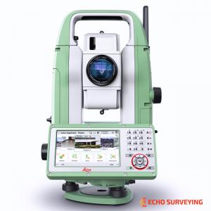
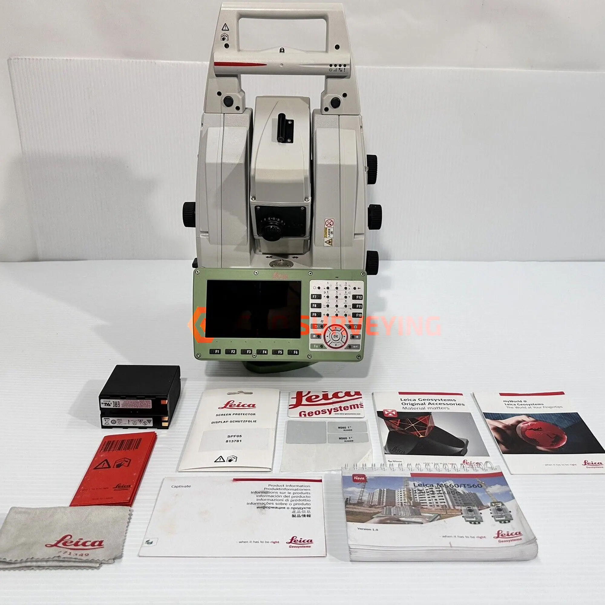

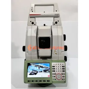
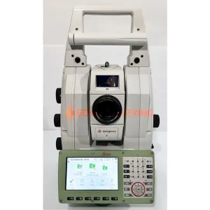
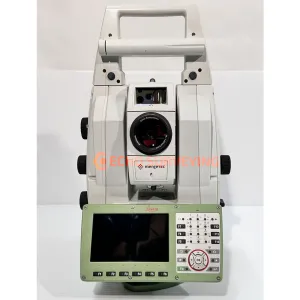
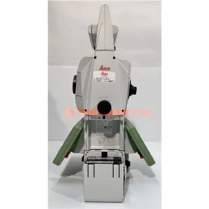
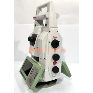
Used Leica Nova MS60 R2000 1” Multistation for sale, professionally serviced and calibrated by Leica authorized, includes official Certificate of Calibration and 1-Year Extended Warranty
Condition: Still like new and well taken care of with minimal signs of use, Firmware Updates (Performance Improvements, App Enhancements & New Features)
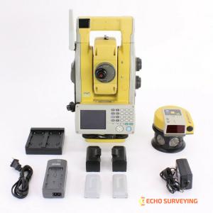
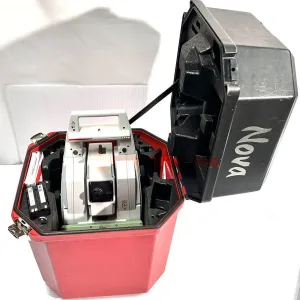
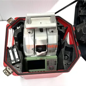
Package includes:
The ultimate all-rounder, a scanning, self-learning total station with GNSS connectivity and digital imaging.
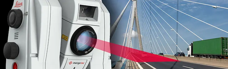
The Leica Nova MS60, the world’s first self-learning MultiStation, enables you to perform all surveying tasks with one instrument. The MS60 is a scanning total station that empowers complete data collection of individual points and large areas by leveraging sensor fusion and automation. Seamlessly integrated into Leica field and office surveying software, you can quickly complete your work on-site and offer a range of high-value deliverables.
The new version of Leica Nova MS60, the world’s first MultiStation, enables you to perform all surveying tasks with one instrument. It brings sensor fusion to the next level by combining:
The MS60 comes with Leica Captivate, an onboard software with easy-to-use apps that cover all your surveying tasks. To make your work even more productive, you can benefit from the MS60’s Dynamic Lock feature as well as the newly added, revolutionary setup assistant feature, Autoheight Feature - which helps you setup even faster and more accurately with the simple press of a button.

Highest-end total station
Highly accurate angle and distance measurements, robust design and easy-to-use apps. With improved automated functionalities, like Dynamic Lock and Autoheight, and the self-learning ARTplus features, the MS60 increases your efficiency, even in the most challenging conditions.

3D laser scanning
Scan up to 30,000 points per second (Hz) to complete your work quickly and get dense scanning grids. The MS60 features optimised scanning paths, including zenith scans, allowing you to significantly reduce the total scanning time.
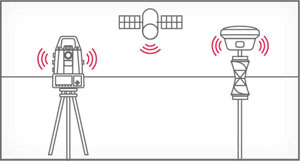
GNSS connectivity
GNSS is fully integrated in the workflow and the data structure, enabling direct georeferencing and increasing your flexibility in the field.

Digital imaging
Digital imaging technology, including an overview and a 30x magnifying telescope camera, enables accurate image-assisted surveying both at the instrument and remotely, while also including extended image documentation.
When to use the Leica Nova MS60?
Traditional surveying and so much more. Learn ways our scanning total station enables measurement tasks and deliverables for a range of sites and structures.
| LEICA NOVA MS60 DATA SHEET | ||
| ANGLE MEASUREMENT | ||
| Accuracy Hz and V | Absolute, continuous, quadruple | 1” (0.3 mgon) |
| DISTANCE MEASUREMENT | ||
| Range 2 / Accuracy / Measurement time | Prism (GPR1, GPH1P) Single (any surface) |
1.5m to >10,000m / 1mm + 1.5ppm / typ. 1.5s 1.5m to 2,000m / 2mm + 2ppm / typ. 1.5s |
| Measurement technology | Wave Form Digitising | Coaxial, visible red laser, dot size 8mm x 20mm @ 50m |
| SCANNING | ||
| Scan Rate / Maximum Scan Speed | 30.000 Hz | 30,000 points per second |
| Max. Range 7 / Range noise (1 sigma) | 30 kHz mode 8 kHz mode 1 kHz mode 1 Hz mode |
60m / 3mm @ 50m 150m / 1.5mm @ 50m 300m / 1.0mm @ 50m 1,000m / 0.6mm @ 50m |
| Scan data | 3D point cloud including true colour, intensity and signal-to-noise data | |
| Scan duration | Full dome scan 400gon x 155gon Band Scan 400gon x 50gon |
Resolution 50mm @ 15m, duration 12mins Resolution 12.5mm @ 50m, duration 45mins |
| IMAGING | ||
| Overview and telescope camera | Resolution / Frame rate Field of view (overview / telescope |
5 MPx CMOS / up to 20 fps 19.4° / 1.5° |
| MOTORISATION | ||
| Direct drives based on Piezo technology | Rotation speed / Time to change face | Maximum 400 gon (360°) per s / typically 2.9s |
| AUTOMATIC AIMING - ATRplus | ||
| Target aiming range2 / Target locking range2 | Circular prism (GPR1, GPH1P) 360° prism (GRZ4, GRZ122) |
1,500m / 1,000m 1,000m / 1,000m |
| Accuracy / Measurement time | ATRplus angle accuracy Hz, V | 1” (0.3 mgon) / typically 2.5s |
| POWERSEARCH | ||
| Range / Search time | 360° prism (GRZ4, GRZ122) | 300m / typically 5s |
| GUIDE LIGHT (EGL) | ||
| Working range / Accuracy | ||
| GENERAL | ||
| Operating system / Field software | Windows EC7 / Leica Captivate and its apps, supports onsite and realtime decisions | |
| Processor | TI OMAP4430 1GHz Dual-core ARM® Cortex™- A9 MPCore™ | |
| Autofocus telescope | Magnification / Focus Range | 30 x / 1.7m to infinity |
| AutoHeight Module | Distance accuracy Distance range |
1.0 mm (1 Sigma) 0.7 m to 2.7 m |
| Display and keyboard | 5“ (inch), WVGA, colour, touch, both faces | 37 keys, illumination |
| Operation | 3x endless drives, 1x Servofocus drive, 2x Autofocus keys, user-definable SmartKey | |
| Power management | Exchangeable Lithium-Ion battery | Up to 9h, internal charging capability |
| Data storage | EInternal memory / Memory card | 2 GB / SD card 1 GB or 8 GB |
| Interfaces | RS232, USB, Bluetooth®, WLAN | |
| Weight | MultiStation including battery | 7.7kg |
| Environmental specifications | Working temperature range Dust & Water (IEC 60529) / Blowing rain Humidity |
–20°C to + 50°C IP65 / MIL-STD-810G, Methods 506.5 I and 507.5 95%, non-condensing |
Downloads