New Leica RTC360 3D Laser Scanner for sale, 1 year RTC360 CCP Basic (Customer Care Package), Leica Cyclone FIELD 360, Leica Cyclone REGISTER 360, Backpack and tripod
New Leica RTC360 3D Laser Scanner for sale, 1 year RTC360 CCP Basic (Customer Care Package), Leica Cyclone FIELD 360, Leica Cyclone REGISTER 360, Backpack and tripod
Leica RTC360 sale package includes:
If you are looking for a used 3d scanner for sale then you are in the right place. We have in for sale used 3d laser scanner from Leica, Trimble, FARO, Artec, etc. For information we currently have used Leica RTC360 for sale at best attractive price
Used surveying equipment fairly straightforward, the prices are far lower than new equipment. If you plan on using the surveying equipment for a long project, it’s probably a more cost-effective choice than buying new one.
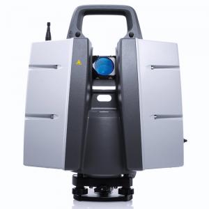
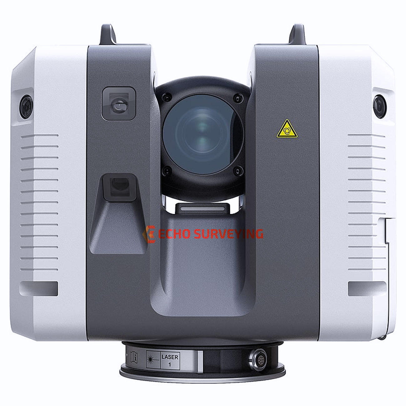
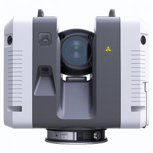
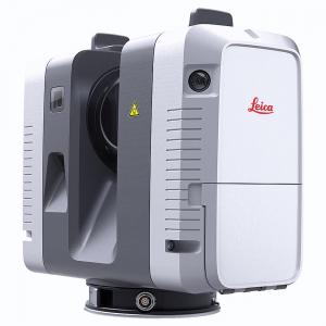
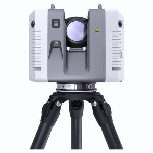
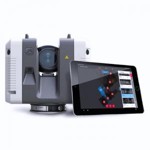
Leica RTC360, a laser scanner equipped with edge computing technology to enable fast and highly accurate creation of 3D models in the field, combines high-performance laser scanning, edge computing and mobile app technologies to pre-register captured scans quickly and accurately. With the push of a button, two million points per second of High Dynamic Range (HDR) imagery can be captured to create a full-dome scan in under two minutes. Laser scanner movements between setup positions are automatically tracked by a Visual Inertial System (VIS) while scans are combined and pre-registered on a mobile device, where they can be viewed and augmented with information tags – saving precious time and speeding up decision-making right from the field. With Leica Cyclone FIELD 360 field application and Leica Cyclone REGISTER 360 office software, the 3D reality capture solution is one of a kind.
The Leica RTC360 has been designed for maximum productivity. For construction professionals, plant operators, public safety officials, and other professionals who face complex projects with tight constraints, it provides a better way to digitally capture the reality of their sites – and process and visualise that data for faster, immediate decision makin
The Leica RTC360 3D reality capture solution empowers users to document and capture their environments in 3D, improving efficiency and productivity in the field and in the office through fast, simple-to-use, accurate, and portable hardware and software. The RTC360 3D laser scanner is the solution for professionals to manage project complexities with accurate and reliable 3D representations and discover the possibilities of any site.
Pre-registraton in the field
As part of the RTC360 solution, the Cyclone FIELD 360 app links the 3D data acquisition in the field with the laser scanner and data registration in the office with Cyclone REGISTER 360. On-site the user can automatically capture, register and examine scan and image data. The user interface combines easy handling of complex calculations with a graphical user guidance that offers a remarkable user experience, also for novice users
LEICA RTC360 PRODUCT SPECIFICATIONS
 |
|
| GENERAL | |
| 3D Laser Scanner | High-speed 3D laser scanner with integrated HDR spherical imaging system and Visual Inertial System (VIS) for real time registration |
| PERFORMANCE | |
| Data acquisition | <2 mins for complete full dome scan and spherical HDR image at 6mm @ 10 m resolution |
| Real time registration | Automatic point cloud alignment based on real time tracking of scanner movement between setups based on Visual Inertial System (VIS) by video- enhanced inertial measurement unit |
| Double scan | Automatic removal of moving objects |
| SCANNING | |
| Distance measurement | High-speed, high dynamic time of flight enhanced by Waveform Digitising (WFD) technology |
| Laser class | 1 (in accordance with IEC 60825-1:2014), 1550 nm (invisible) |
| Field of view | 360° (horizontal) / 300° (vertical) |
| Range | Min. 0.5 - up to 130 m |
| Speed | Up to 2,000,000 pts / sec |
| Resolution | 3 user selectable settings (3/6/12 mm @ 10 m) |
| Accuracy | Angular accuracy 18” Range accuracy 1.0 mm + 10 ppm 3D point accuracy 1.9 mm @ 10 m 2.9 mm @ 20 m 5.3 mm @ 40 m |
| Range noise | 0.4 mm @ 10 m, 0.5 mm @ 20 m |
| IMAGING | |
| Camera | 6 MP 3-camera system captures 432 MPx raw data for calibrated 360° x 300° spherical image |
| Speed | 1 minute for full spherical HDR image at any light condition |
| HDR | Automatic, 5 brackets |
| NAVIGATION SENSORS | |
| Visual Inertial System | Video enhanced inertial measuring system to track movement of the scanner position relative to the previous setup in real time |
| Tilt | IMU based, Accuracy: 3‘ for any tilt |
| dditional sensors | Altimeter, Compass, GNSS |
| OPERATION | |
| On scanner | Touch-screen control with finger touch, full colour WVGA graphic display 480 x 800 pixels |
| Mobile devices | Leica Cyclone FIELD 360 app for iPad or Android tablets including: - Remote control of scan functions - 2D & 3D data viewing - Tagging - Automatic alignment of scans |
| Wireless | Integrated wireless LAN (802.11 b/g/n) |
| Data storage | Leica MS256, 256 GB exchangeable USB 3.0 flash drive |
| DESIGN & PHYSICAL | |
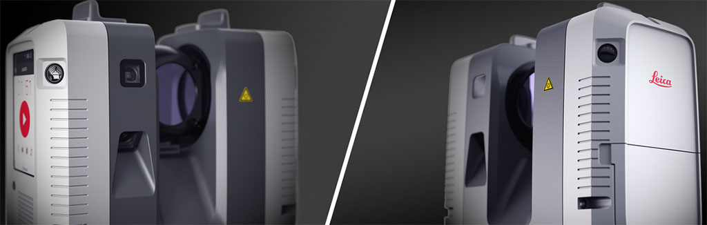
| Housing | Aluminium frame and sidecovers |
| Dimensions | 120 mm x 240 mm x 230 mm / 4.7‘‘ x 9.4‘‘ x 9.1‘‘ |
| Weight | 5.35 kg / 11.7 lbs, nominal (without batteries) |
| Mounting mechanism | Quick mounting on 5/8“ stub on lightweight tripod / optional tribrach adapter / survey tribrach adapter available |
| POWER | |
| Internal battery | 2 x Leica GEB361 internal, rechargeable Li-Ion batteries. Duration: Typically up to 4 hours Weight: 340 g per battery |
| External | Leica GEV282 AC adapter |
| ENVIRONMENTAL | |
| Operating temperature | -5° to +40°C |
| Storage temperature | -40° to +70°C |
| Dust/Humidity | Solid particle/liquid ingress protection IP54 (IEC 60529) |
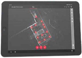
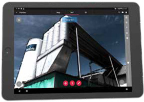
View: As part of the Leica Geosystems Reality Capture 360 solution, the high- performance Leica Cyclone FIELD 360 mobile-device app is the perfect field companion for the Leica RTC360 3D laser scanner.
With its intuitive user interface, remote scanner control and on-site point cloud display, navigation is a breeze - even for novice users – with full imagery and point cloud data delivered directly to your tablet using edge computing technology.
Check: Direct data access and visualisation are the foundation for quality control in the field; with Cyclone FIELD 360, automatically pre-registered point cloud data enables users to quickly conduct on-site quality control checks, improves productivity and makes for better-informed decisions in the field.
Add: For improved registration in Leica Cyclone REGISTER 360 post-processing, and to add extra value and information to 3D data, Cyclone FIELD 360 enables on-site tagging of measurements, videos, images, text or voice files to the point cloud geometry simply by using your table
LEICA CYCLONE FIELD 360 PRODUCT SPECIFICATIONS
| GENERAL | |
| iOS or Android app | In-the-field app for remote scanner control, data management, quality control, data tagging and automatic pre-registration on-site |
| SCANNER CONTROL | |
| Remote scanner control with access to all control features | |
| DATA MANAGEMENT | |
| Create, edit and delete scan jobs | |
| DATA COMMUNICATION & TRANSFER | |
| Communication | Bi-directional wireless communication between scanner and table |
| Transfer |
Automatic transfer of scan data from scanner to tablet; automatic synchronisation of all app created data from tablet to scanner |
| QUALITY CONTROL | |
| Point cloud navigation | Navigate single and registered point clouds in 2D map view, 360° panoramic view or in full 3D view |
| Point cloud display | Display point clouds in full HDR colour, rainbow intensity or grey-scale mapping |
| Measurement | Take and tag measurements within the point cloud |
| DATA TAGGING | |
| Add image, video, voice, text or any other file-based tags to point cloud | |
| PRE-REGISTRATION | |
| Auto alignmen | Visual Inertial System (VIS) technology based automated alignment of scan setups for targetless cloud-to-cloud registratiON |
| Visual alignment | Move and rotate scan setups for a quick visual alignment for cloud-to-cloud registration |
| INTEROPERABILITY | |
| Sensor hardware | Leica RTC360 laser scanner |
| Cyclone software |
Leica Cyclone REGISTER 360 1.5 or higher, requires active REGISTER 360 license foractivation |
| SYSTEM REQUIREMENTS | |
| Platform | Android tablet computer running on Android 6.0 or higher, e.g. Samsung Galaxy Tab S3 Apple iPad tablet computer running on iOS 11.1 or higher, e.g. iPad Pro with 10.5“ scree |
|
AUTO-ALIGNED POINT CLOUDS IN 2D VIEW MODE 360° VIEW OF POINT CLOUD
 |
|
Downloads